For my Art strategies final project I’d like to continue to work in a similar theme to what I’ve made previously involving routes and paths through cities (mostly new york). I’m thinking it will be a sort of neon sign sign for my apartment building. I’m planning to use EL wire sewn onto a canvas to create a map of routes that people in my building frequently take (maybe to work, school, or a friend’s house). This is roughly what it may look like: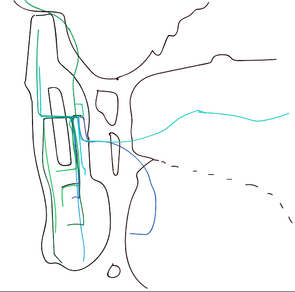
I’m hoping that the physical EL wire looks good when bunched up on the canvas to add weight to common routes. I found a similar use of EL wire in Anna Madeleine’s Submarine Cable Map (2016):


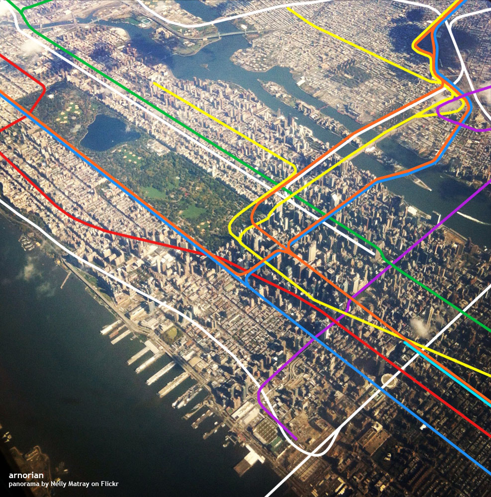
At this point I’m unsure of what else I’d like on the canvas. I’ve considered a simple reference map like I sketched out in the first image or maybe a full arial photography. I really like how these images look with the subway lines superimposed:
I’m going to post a sign up sheet in my building to collect some real destinations but failing that I’m going to try to make them up based on real data.
Additional thoughts:
Like a neon sign for beer in a bar window. This is what this apartment building has!
I think of this as presenting a “chicken/egg” question in reference to housing, place and identity or the idea that the destinations construct the origin.
Visualizing individual routes in the same way we might view subway lines is interesting to me – its sort of like using a microscope on urban transit issues.
I’d like to make a series of these on the same canvas. I think it could be really interesting to add new buildings and their associated routes to this over time. It would create multiple hubs and interwoven spokes that would make the people flows more distinct and make the broader system I am referring to clearer. This is especially interesting with no base map. How many buildings would I have to add before the form of New York becomes obvious? Is New York defined by the paths we carve through it?
Questions:
How big should this be?
What about the basemap?
Would other interactivity add anything to this?
How do I solicit this information from my neighbors?
Are there questions I need to ask myself about this?